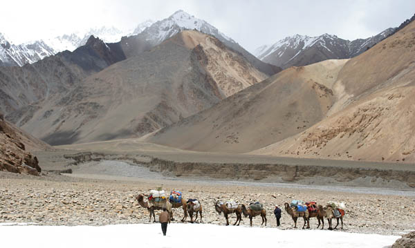
The Trek
Yilik to Kotaz | Kotaz to Base Camp | Base
Camp to ABC | ABC to Kotaz | Return to Yilik
Yilik to Kotaz
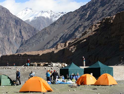 MAY 30 - Our trek began in an unnamed river junction
16 km before Yilik. As we waited two days for the camels to arrive,
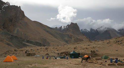
we familiarized ourselves with the gear: a Chinese "domestic
quality" tent for each trekker, a large meal tent with dining
table and folding chairs, and a cook tent. In the background,
a woman and her child drive a herd of sheep back toward their
dwelling on the other side of the river.
MAY 30 - Our trek began in an unnamed river junction
16 km before Yilik. As we waited two days for the camels to arrive,
we familiarized ourselves with the gear: a Chinese "domestic
quality" tent for each trekker, a large meal tent with dining
table and folding chairs, and a cook tent. In the background,
a woman and her child drive a herd of sheep back toward their
dwelling on the other side of the river.
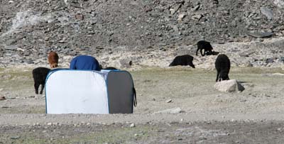 We also familiarized ourselves with our toilet facility,
a nylon frame around a shallow hole in the ground. Occasionally
this piqued the interest of the grazing sheep.
We also familiarized ourselves with our toilet facility,
a nylon frame around a shallow hole in the ground. Occasionally
this piqued the interest of the grazing sheep.
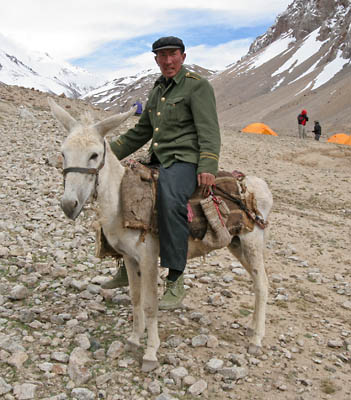
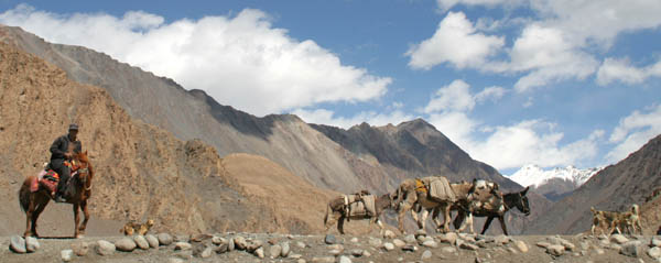 This was one of the few people we saw travelling by
horse. Most people used donkeys.
This was one of the few people we saw travelling by
horse. Most people used donkeys.
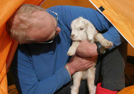
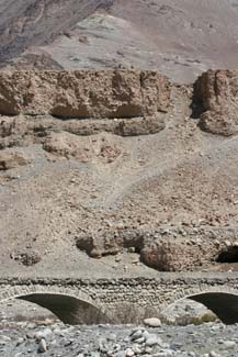 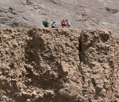 Many of us used the rest day to stretch our legs and
check out the views. Across the river there was a bluff that
was a popular destination. You can just barely make out people
at the top of the bluff in the picture on the left. Also note
the cave just above the right span of the bridge. The local herders
were using it as a nursery for baby goats.
Many of us used the rest day to stretch our legs and
check out the views. Across the river there was a bluff that
was a popular destination. You can just barely make out people
at the top of the bluff in the picture on the left. Also note
the cave just above the right span of the bridge. The local herders
were using it as a nursery for baby goats.
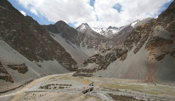 The view of our camp from the top of the bluff. Note
the clear river running under the bridge and meeting the muddy
Yarkand river on the left. The clear river emerged out of the
ground just a quarter mile up the valley on the right.
The view of our camp from the top of the bluff. Note
the clear river running under the bridge and meeting the muddy
Yarkand river on the left. The clear river emerged out of the
ground just a quarter mile up the valley on the right.
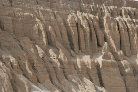
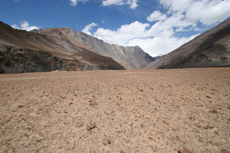 The plain at the top of the bluff was a Mars-scape.
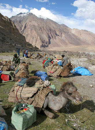
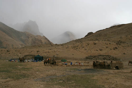
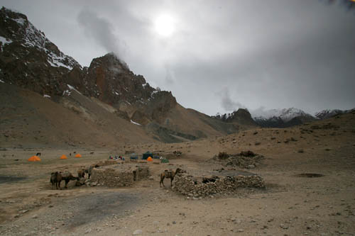
 A welcome sight: The camels arrive at our camp site.
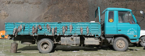 Catfish dry in the sun on the side of our gear truck.
The fish would make an appearance in our lunch boxes halfway
through the trek.
Catfish dry in the sun on the side of our gear truck.
The fish would make an appearance in our lunch boxes halfway
through the trek.
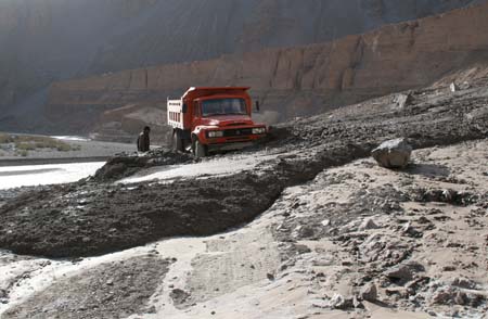 MAY 31 - The next morning we drove to the first mudslide
and began our trek. There was a large dump truck stuck in the
second mudslide. The two men digging it out had a tough job ahead
of them.
MAY 31 - The next morning we drove to the first mudslide
and began our trek. There was a large dump truck stuck in the
second mudslide. The two men digging it out had a tough job ahead
of them.
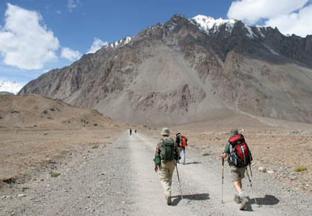 The road walking was easy, especially after two days
of rest at 11,800 feet elevation.
The road walking was easy, especially after two days
of rest at 11,800 feet elevation.
 As we approached Yilik, the terrain and the views
opened up.
As we approached Yilik, the terrain and the views
opened up.
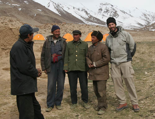
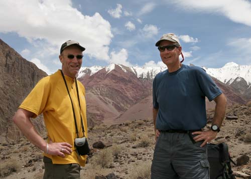 Bill and Jim.
YILIK: Yilik is a military post, so no photos
are allowed in the vicinity. We made it through the checkpoint
in about an hour and had lunch across the river from the base.
Here, we met a German group that was returning from Base Camp.
They had not had good weather. It snowed often, and they had
no more than a fleeting view of K2 on their way out of the Sarpo
Lago valley. We picked up our chief cook, Kaiser (KAY-sir), from
their group.
Bill and Jim.
YILIK: Yilik is a military post, so no photos
are allowed in the vicinity. We made it through the checkpoint
in about an hour and had lunch across the river from the base.
Here, we met a German group that was returning from Base Camp.
They had not had good weather. It snowed often, and they had
no more than a fleeting view of K2 on their way out of the Sarpo
Lago valley. We picked up our chief cook, Kaiser (KAY-sir), from
their group.
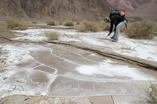 Not far out of Yilik, we hiked out of the river plain
to avoid having to cross the river. Here, in the dried mud, we
found some Uygur graffiti scratched in the parched ground. Dulkin
attributed the quote to Deng
Xiaoping and translated it as "beautiful money is beautiful
life". I think the more common English translation is "Poverty
is not socialism. To get rich is glorious."
Not far out of Yilik, we hiked out of the river plain
to avoid having to cross the river. Here, in the dried mud, we
found some Uygur graffiti scratched in the parched ground. Dulkin
attributed the quote to Deng
Xiaoping and translated it as "beautiful money is beautiful
life". I think the more common English translation is "Poverty
is not socialism. To get rich is glorious."
 We returned to the river plain and rounded the final
corner from the Surakwat River to the Zug Shagskam River.
We returned to the river plain and rounded the final
corner from the Surakwat River to the Zug Shagskam River.
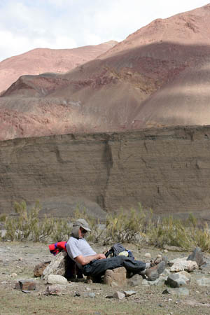
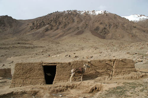
 Near the end of a long day, David rests against an
abandoned hut.
Near the end of a long day, David rests against an
abandoned hut.
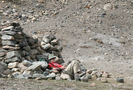
 Bill K. takes a nap on a not-so-comfy looking lounge
chair.
Bill K. takes a nap on a not-so-comfy looking lounge
chair.
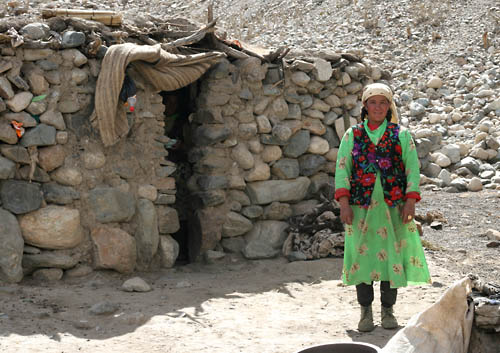 We arrived at a small settlement consisting of two
stone huts, where were two Kirgiz women. They were very kind
offered me some water and bread after I took this picture. Note
the coke bottle and other items used to plug holes in the hut.
We arrived at a small settlement consisting of two
stone huts, where were two Kirgiz women. They were very kind
offered me some water and bread after I took this picture. Note
the coke bottle and other items used to plug holes in the hut.
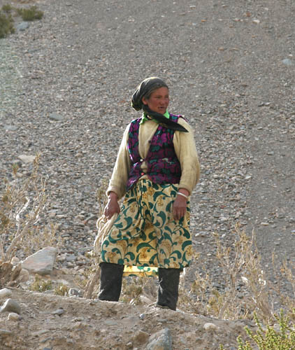
 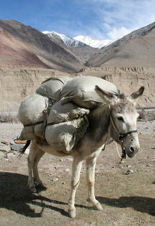 We ended up camping in front of the women's stone
huts. At right, a local donkey poses with a load of feed.
We ended up camping in front of the women's stone
huts. At right, a local donkey poses with a load of feed.
 JUNE 1 - After a windy, rainy night, we awoke to a
sunshine. One of the camel drivers walked down to the edge of
the river and began to sing. The sound of his voice echoing off
the rugged bluffs, blended with the bleating of lambs, was sublime.
JUNE 1 - After a windy, rainy night, we awoke to a
sunshine. One of the camel drivers walked down to the edge of
the river and began to sing. The sound of his voice echoing off
the rugged bluffs, blended with the bleating of lambs, was sublime.
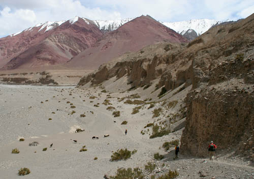
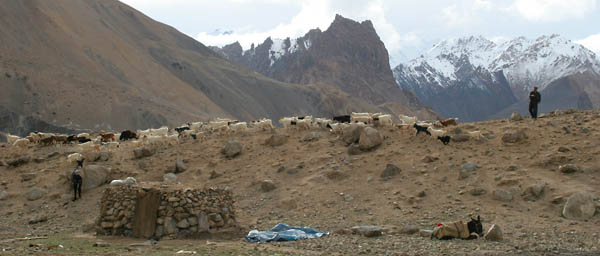
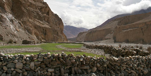 Soon after we left camp, there was an impressive sheep
corral. Aqueducts drew water from the river, and a small spring
provided additional moisture. A camel-proof wall protected the
sorghum crop from camels. Numerous stone structures dotted the
hills and cliffs above.
Soon after we left camp, there was an impressive sheep
corral. Aqueducts drew water from the river, and a small spring
provided additional moisture. A camel-proof wall protected the
sorghum crop from camels. Numerous stone structures dotted the
hills and cliffs above.
 Is this really it? Four hours out of our last camp,
we arrive at a small grove of willow bushes (not shown) near
a junction with a narrow side canyon. We learn from the staff
that this is indeed Sarak, our camp for the night.
Is this really it? Four hours out of our last camp,
we arrive at a small grove of willow bushes (not shown) near
a junction with a narrow side canyon. We learn from the staff
that this is indeed Sarak, our camp for the night.
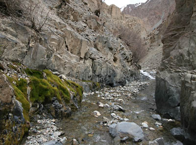 The short day gave us plenty of time for exploration.
Rich Mikita and I hiked up the narrow side canyon as far as we
could. In this arid landscape, we were quite surprised to find
moss.
The short day gave us plenty of time for exploration.
Rich Mikita and I hiked up the narrow side canyon as far as we
could. In this arid landscape, we were quite surprised to find
moss.
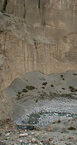
 Near our turnaround point, there were two cascades
dropping maybe 100 feet from the bluffs above. Their sources
were probably springs. There were also bushes large enough to
be considered trees.
Near our turnaround point, there were two cascades
dropping maybe 100 feet from the bluffs above. Their sources
were probably springs. There were also bushes large enough to
be considered trees.
 |
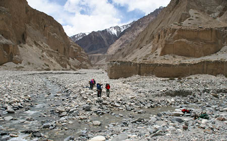
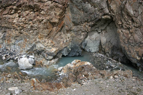
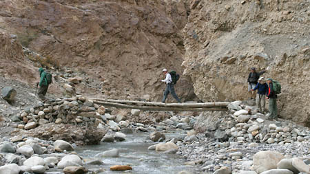 JUNE 2 - Not far out of camp, the Suruquat River valley
narrowed into a deep canyon. We crossed the river on a sod bridge
(shown above and at the bottom of the picture at left) and swtichbacked
up out of the river bed. Below is a view staight down into the
canyon.
JUNE 2 - Not far out of camp, the Suruquat River valley
narrowed into a deep canyon. We crossed the river on a sod bridge
(shown above and at the bottom of the picture at left) and swtichbacked
up out of the river bed. Below is a view staight down into the
canyon.
|
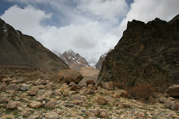 Out of the river plain, the terrain was much more
rocky.
Out of the river plain, the terrain was much more
rocky.
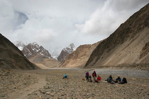 However, there was a much more established trail,
so the going was easy. Here, we're taking a typical snack break.
However, there was a much more established trail,
so the going was easy. Here, we're taking a typical snack break.
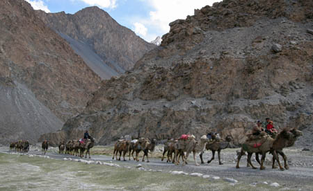
 As we turned out of the Suruquat River valley toward
Kotaz, we hit our first snow. The camels had a little more trouble
with it than we did.
As we turned out of the Suruquat River valley toward
Kotaz, we hit our first snow. The camels had a little more trouble
with it than we did.
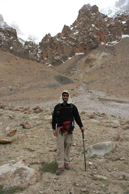 Me, wearing my dorky but practical hat. Even on a
cloudy day, the UV at this elevation can be as strong as on a
sunny day at sea level.
Me, wearing my dorky but practical hat. Even on a
cloudy day, the UV at this elevation can be as strong as on a
sunny day at sea level.
On to Kotaz
to Base Camp...
|